Why Is Joshimath Sinking — And Could It Happen Again Elsewhere?
The Joshimath sinking crisis has raised urgent questions about land subsidence in Uttarakhand, fragile Himalayan geology, and whether rapid infrastructure development is pushing mountain towns beyond their limits.
It began quietly.
A thin crack across a living room wall.
A door that wouldn’t shut properly.
A road that felt slightly uneven underfoot.
Then the cracks widened. Floors tilted. Windows jammed. Entire neighborhoods were marked unsafe.
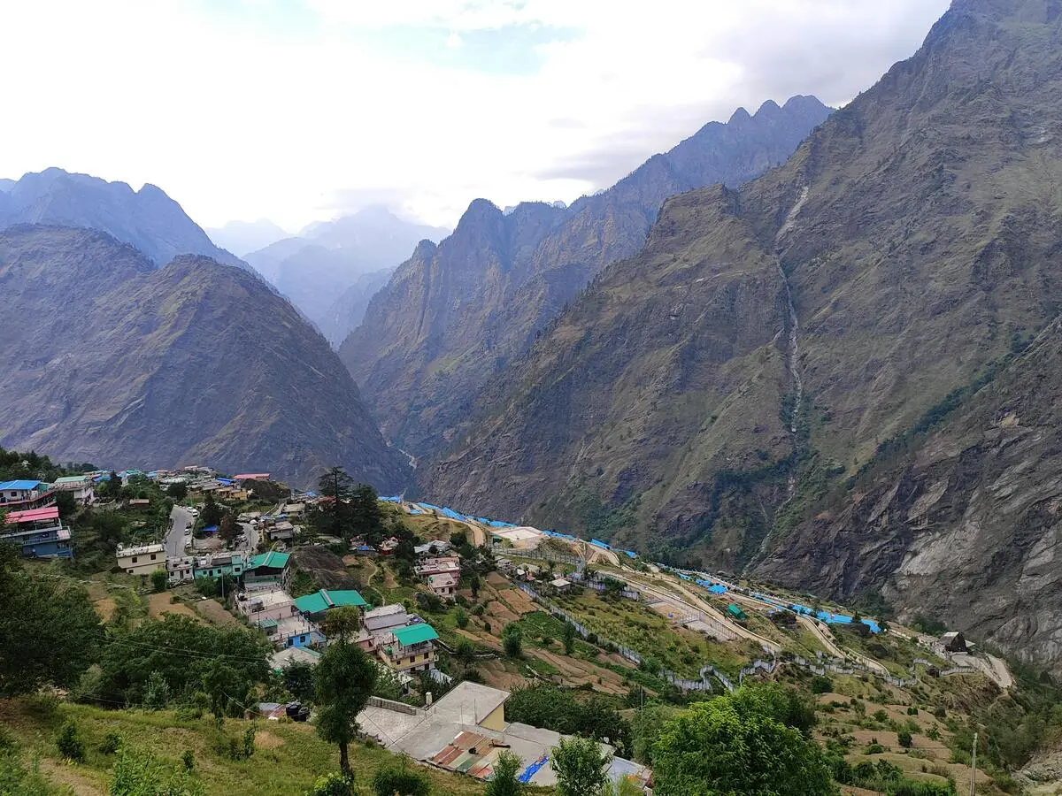
Joshimath — a small but significant Himalayan town — was sinking.
But this isn’t just about one town.
What’s happening in Joshimath forces us to confront deeper questions about how we build in fragile mountain regions, how climate change is reshaping the Himalayas, and whether development is moving faster than nature can safely allow.
So why is Joshimath sinking?
And why should the rest of us be paying attention?
Where Is Joshimath — And Why Is It So Important?
Joshimath sits in the Chamoli district of Uttarakhand. It is not just another hill town.
It serves as:
- The gateway to Badrinath
- A major stop on the Char Dham pilgrimage route
- The base camp for trekking and skiing in Auli
- A strategically important town near the India–China border
Every year, thousands of pilgrims and tourists pass through. Over time, hotels multiplied. Roads were widened. Buildings rose where open slopes once stood.
Economic growth followed.
But the ground beneath the town was never entirely stable.
And that matters.
Why Is Joshimath Sinking? Understanding Land Subsidence
The technical term behind the Joshimath crisis is land subsidence — the gradual sinking of the ground due to instability beneath the surface.
In simple terms: the land is slowly collapsing.
Land subsidence in Uttarakhand’s mountainous terrain can occur due to:
- Weak geological formations
- Water seepage into soil layers
- Slope cutting during road construction
- Heavy building loads
- Vibrations from tunneling or blasting
One major reason behind Joshimath sinking is that the town was built on old landslide debris rather than solid bedrock. Geological assessments have long classified the region as highly vulnerable to slope instability.
When heavy construction is added on top of fragile debris layers, pressure builds.
It’s like placing concrete towers on compressed gravel.
Eventually, the ground adjusts.
Were There Warning Signs?
Yes.
As far back as the 1970s, expert committees warned that Joshimath’s terrain was unstable. They recommended strict construction control and careful planning.
But over decades, religious tourism expanded. Infrastructure projects accelerated. More roads were carved into slopes. Drainage networks expanded. Water seeped into already fragile soil.
The mountain absorbed the stress — until it couldn’t.
The current Joshimath sinking crisis did not emerge overnight. It developed gradually, shaped by long-term pressure.
Similar warnings were overlooked before the 2013 Kedarnath disaster, when unregulated construction amplified the impact of extreme rainfall.
The Role of Infrastructure and the Char Dham Project
The debate around why Joshimath is sinking often centers on infrastructure expansion in the region.
The Char Dham road project was launched to improve connectivity to pilgrimage sites. However, concerns around the Char Dham Highway environmental impact have intensified since the Joshimath sinking crisis began. Better roads bring economic opportunity, faster travel, and strategic advantage.
But building highways in the Himalayas is not simple.
Mountain road widening involves:
- Cutting steep slopes
- Excavating fragile rock layers
- Disposing debris
- Sometimes blasting for tunnels
Critics argue that large-scale construction in geologically sensitive zones increases landslide risk and slope destabilization. Supporters counter that infrastructure is essential for livelihoods, emergency access, and national security.
The tension between development and ecological limits sits at the heart of the Joshimath sinking crisis.
Climate Change: The Risk Multiplier
Even without construction pressure, another powerful force is reshaping the Himalayas — climate change.
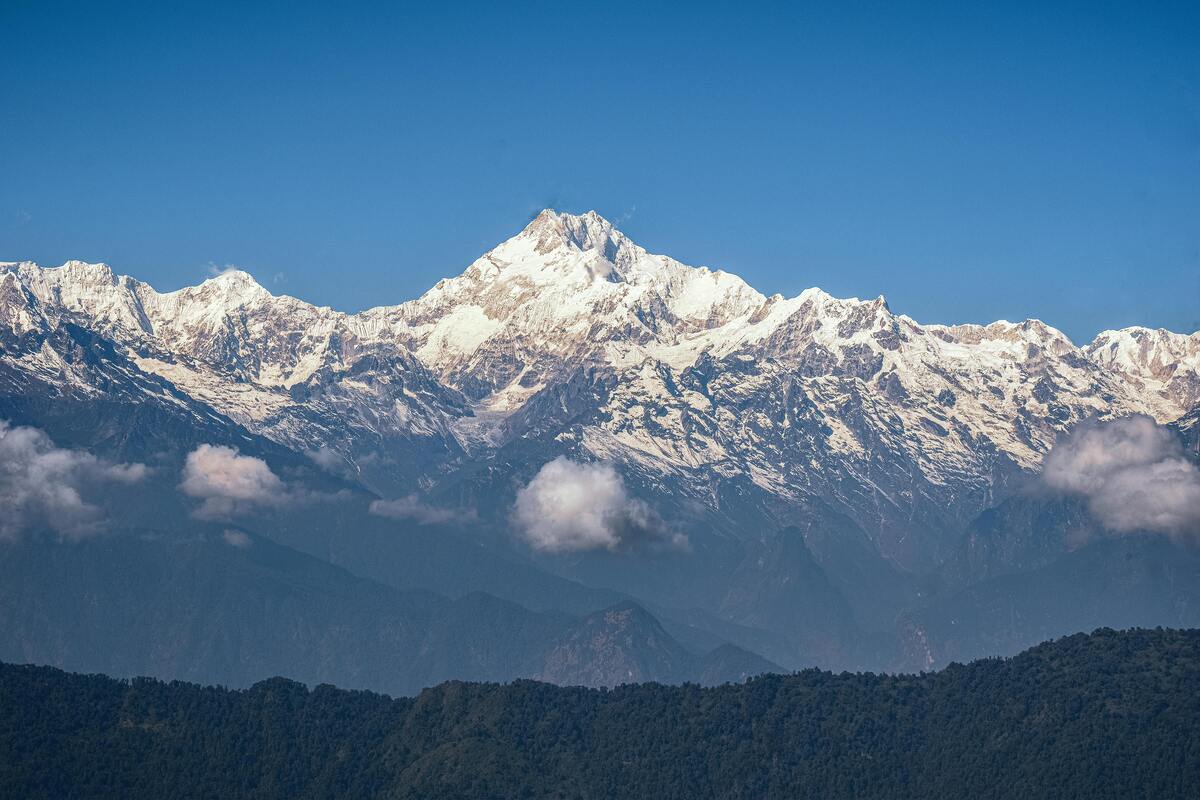
The region is warming faster than many parts of the world. Research points to accelerating glacier retreat, shifting snowfall patterns, and a noticeable rise in extreme rainfall events.
Across the Himalayan belt, this is already visible:
- Glaciers are retreating
- Snowfall patterns are becoming less predictable
- Extreme rainfall events are increasing
- Cloudbursts are growing more intense
When heavy rain hits freshly cut slopes, the risk of landslides rises sharply. Water seeps into loose debris layers, weakening underground support and increasing instability.
Climate change does not directly cause land subsidence — but it intensifies existing geological weaknesses.
Joshimath now sits at the intersection of fragile terrain, infrastructure stress, and increasingly volatile climate conditions.
That combination is dangerous.
Why the Joshimath Crisis Matters Beyond Uttarakhand
It would be easy to treat this as a local disaster.
But the Joshimath sinking crisis represents a broader warning.
Across the Himalayan belt — from Uttarakhand to Himachal Pradesh and beyond — similar patterns are visible:
- Rapid tourism growth
- Road expansion
- Hydropower projects
- Construction near rivers
- Buildings on unstable slopes
If fragile geology continues to be ignored, other mountain towns could face similar subsidence risks.
Joshimath may not be an isolated incident.
It may be an early signal.
Rising Uttarakhand landslide risk has already been documented across multiple districts
Development vs. Ecological Limits
Let’s be honest: development in Uttarakhand is complex.
Tourism drives income. Pilgrimage sustains local economies. Improved roads enhance disaster response and defense mobility.
But mountains are not plains.
They cannot carry unlimited weight.
They cannot absorb unlimited excavation.
They cannot endlessly adjust to structural pressure.
This is where the idea of “carrying capacity” becomes critical — the maximum level of development a region can sustain without triggering environmental instability.
When carrying capacity is ignored, nature eventually responds.
Sometimes through floods.
Sometimes through landslides.
And sometimes, as in Joshimath, through land subsidence.
The Human Side of the Joshimath Disaster
Beyond geology and policy debates, real lives are affected.
Families were forced to evacuate homes. Shops shut down. Entire neighborhoods waited anxiously as cracks widened.
Some residents marked walls with tape to track how fast fractures were spreading. Others reported hearing unsettling cracking sounds at night.
For them, the Joshimath sinking crisis is not about infrastructure models or climate policy.
It is about safety.
When the ground shifts beneath your feet, abstract debates become very real.
Can Joshimath Be Stabilized?
Land subsidence is difficult to reverse entirely. But damage can sometimes be managed.
Possible stabilization measures include:
- Improved drainage systems
- Restricting further construction
- Reinforcing slopes
- Monitoring groundwater flow
- Relocating high-risk zones
Long-term recovery depends on whether structural stress is reduced.
If heavy excavation continues in unstable terrain, risks remain.
If planning shifts toward sustainable, climate-resilient development, partial stabilization is possible.
What Needs to Change Going Forward?
The Joshimath crisis highlights several urgent lessons:
1. Development Must Match Terrain
Mountain regions require specialized planning models.
2. Environmental Impact Assessments Must Be Rigorous
Not procedural paperwork — but serious geological evaluation.
3. Climate Projections Must Guide Infrastructure
Future rainfall intensity must be factored into design standards.
4. Construction Limits Must Be Enforced
Carrying capacity is not anti-development. It is responsible development.
Without long-term planning, the pattern seen in Joshimath could repeat in other rapidly expanding Himalayan towns.
The Bigger Question
Joshimath is sinking.
But the deeper issue is this:
Are we designing infrastructure for tomorrow’s climate — or yesterday’s?
The Himalayas are changing. Rainfall patterns are intensifying. Glaciers are retreating. Slope instability is increasing.
If infrastructure growth continues without adapting to these realities, similar crises may emerge elsewhere.
The Joshimath sinking crisis might not be an exception.
It might be a warning.
FAQs About Joshimath Sinking
1. Why is Joshimath sinking?
Joshimath is experiencing land subsidence due to fragile geological conditions, heavy construction, slope cutting, groundwater seepage, and increasing rainfall intensity linked to climate change.
2. What is land subsidence in Joshimath?
Land subsidence refers to the gradual sinking of the ground caused by weak soil layers, water infiltration, and structural pressure in a geologically sensitive Himalayan region.
3. Is climate change responsible for the Joshimath crisis?
Climate change is not the sole cause, but rising temperatures and more intense rainfall in the Himalayas increase slope instability and worsen subsidence risks.
4. Is the Char Dham project linked to Joshimath sinking?
Some experts argue that road widening, tunneling, and excavation may contribute to slope instability, though multiple geological and environmental factors are involved.
5. Was Joshimath always geologically unstable?
Yes. Studies dating back decades warned that the town sits on old landslide debris, making it vulnerable to instability.
6. Could other Himalayan towns face similar risks?
Yes. Many towns in Uttarakhand and the broader Himalayan region face similar geological fragility combined with increasing infrastructure pressure and climate stress.
Final Thought
Joshimath is not just about cracks in walls.
It is about cracks in how we think about development in fragile ecosystems.
Mountains are powerful — but they are not limitless.
If we push beyond ecological thresholds, they respond.
The real question is not whether development should happen.
The real question is whether it can happen responsibly — before more ground begins to give way.
Related Articles
Why Himadri is the Highest Himalayan Range (Explained in a Simple Way)
Why is Himadri higher than other Himalayan ranges? Discover the simple reasons behind its height with an easy, beginner-friendly explanation.
Climate Change Impact on Himalayan Rivers
Climate change is rapidly affecting Himalayan rivers like the Ganges, Brahmaputra, and Indus. Learn how glacier melting, changing rainfall, and floods threaten water security for nearly 2 billion people.
Why Himalayan Glaciers Are Melting Faster Than Ever — And Why the World Should Care
Himalayan glaciers are melting faster than ever. Discover the real causes, scientific warnings, and what glacier loss means for rivers, communities, and climate.