Kedarnath Flood 2013: Causes, Impact and Climate Lessons
In June 2013, Kedarnath — one of the most sacred pilgrimage sites in India — witnessed a disaster that changed the Himalayan region forever. What began as heavy monsoon rainfall quickly turned into one of the deadliest natural disasters in Indian history. Entire settlements were washed away, thousands of lives were lost, and the fragile reality of life in the Himalayas became painfully clear.
The Kedarnath flood was not just a story of extreme weather. It was a combination of climate conditions, geography, environmental neglect, and unplanned development. To understand what really happened, we must look deeper — at the land, the rivers, the weather patterns, and the choices humans made.
Where is Kedarnath and Why Is It Vulnerable?
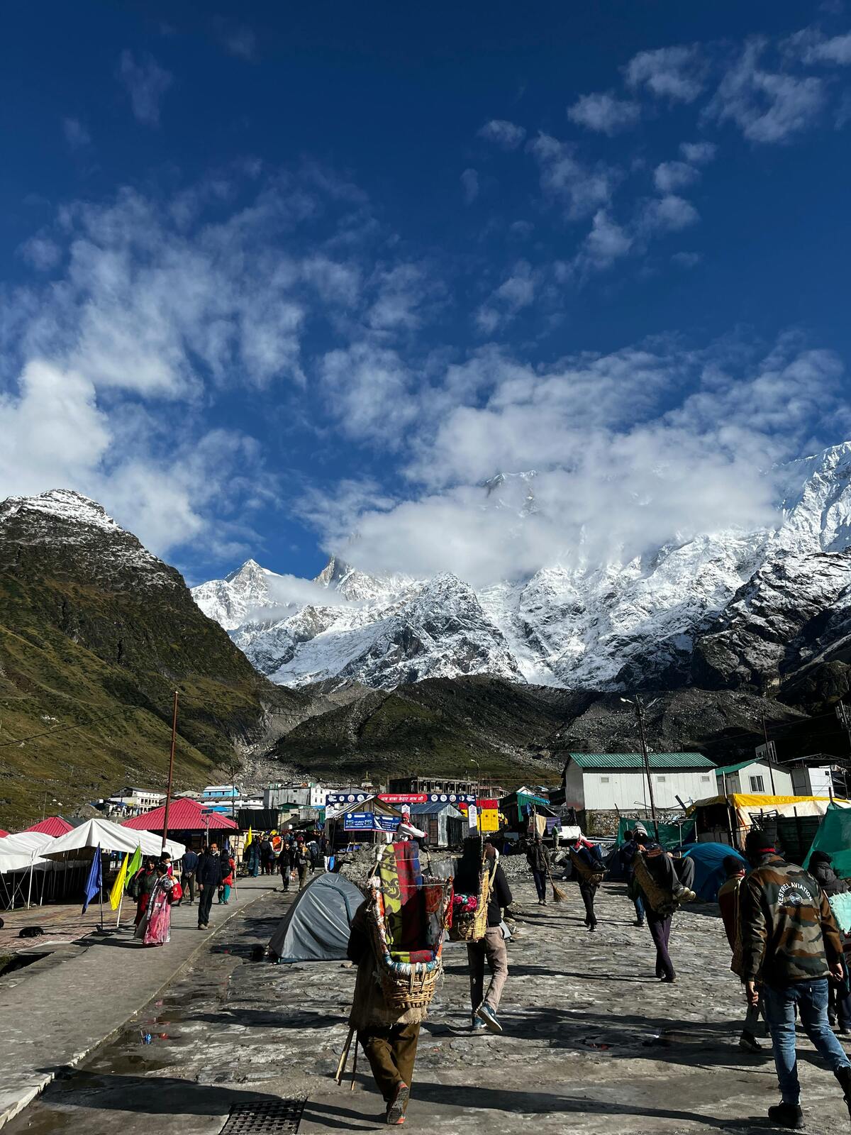
Kedarnath is located in the Rudraprayag district of Uttarakhand at an altitude of about 3,583 meters. It lies near the Mandakini River, surrounded by steep mountain slopes, glaciers, and river valleys.
The Himalayas are young, geologically unstable mountains with steep slopes and fast-flowing rivers, making the region especially vulnerable during heavy monsoon rainfall.
Because of its location near glaciers and river systems, Kedarnath is naturally vulnerable to:
- Flash floods
- Landslides
- Cloudbursts
- Glacial lake outburst floods (GLOFs)
This vulnerability existed long before 2013. But what happened that year made the risks impossible to ignore.
What Happened in June 2013?
Between 14 and 17 June 2013, Uttarakhand experienced unusually heavy rainfall — far more than the seasonal average. The monsoon arrived earlier than expected and brought intense downpours.
At the same time, a glacial lake near Chorabari Glacier (above Kedarnath) overflowed. This sudden release of water, combined with continuous heavy rain, caused massive flooding in the Mandakini River.
Huge amounts of water, mud, rocks, and debris rushed down toward Kedarnath town. Within minutes, buildings were destroyed. Roads disappeared. Communication systems failed. Pilgrims and locals were trapped with little warning.
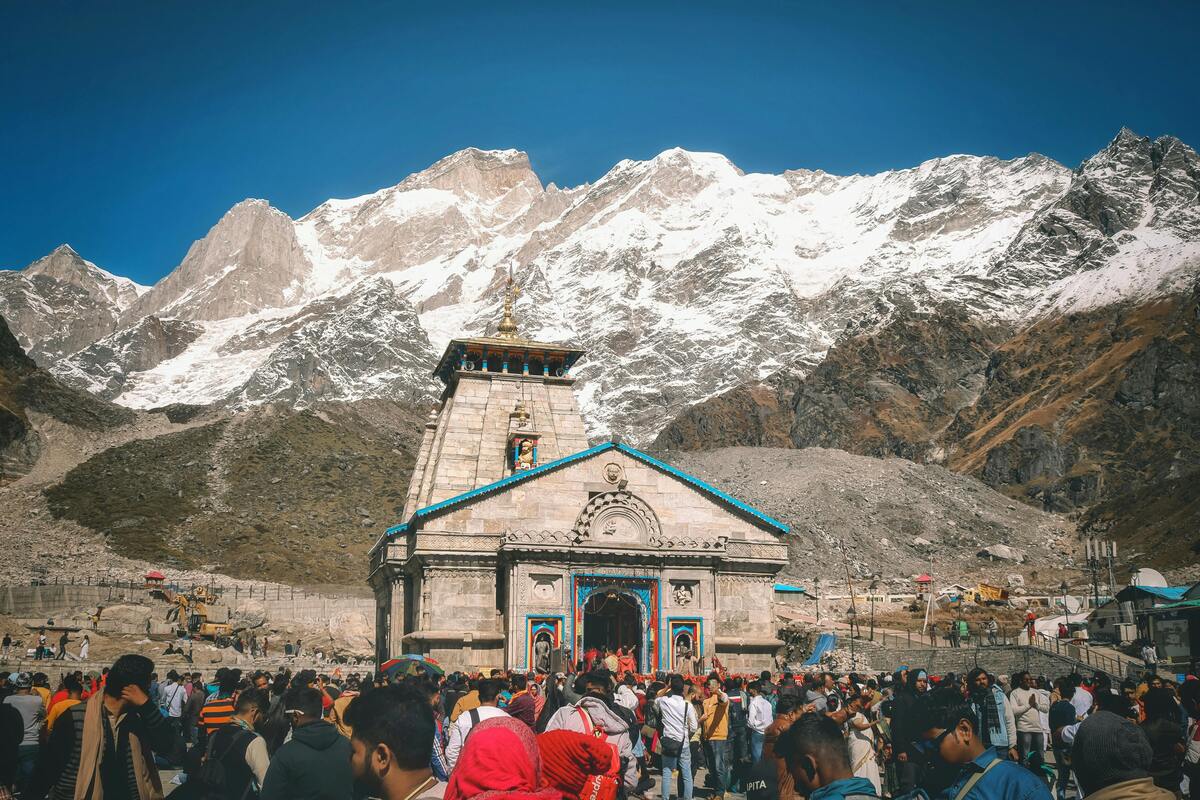
The Kedarnath Temple survived — protected by a large rock that diverted the main flow of debris — but the town around it was devastated.
Main Causes of the Kedarnath Flood
The 2013 disaster was not caused by one single factor. It was the result of multiple climatic and human factors coming together.
1. Extreme Monsoon Rainfall
The primary trigger was unusually heavy rainfall. Some areas recorded rainfall several times higher than normal in just 48 hours.
Such intense rainfall increases river discharge rapidly. In mountain regions, water flows faster because of steep slopes. There is little time for absorption into the soil, leading to flash floods.
Climate scientists have suggested that warming temperatures may increase the intensity of extreme rainfall events in the Himalayas.
2. Glacial Lake Outburst
Above Kedarnath lies the Chorabari Lake, formed by melting glacier water. Continuous rainfall caused the lake to overflow and possibly breach its boundary.
When a glacial lake suddenly releases water, it creates a powerful surge downstream. This phenomenon is called a Glacial Lake Outburst Flood (GLOF).
The combination of GLOF and monsoon rainfall amplified the disaster.
3. Fragile Himalayan Geography
The Himalayas are geologically young mountains. Their rocks are less stable compared to older mountain ranges. This makes landslides common, especially during heavy rain.
When slopes collapse, they add debris to rivers. This debris increases the destructive power of floods.
In Kedarnath’s case, landslides blocked and redirected water flow, making flooding more unpredictable and intense.
4. Unplanned Construction and Development
One of the most discussed causes was uncontrolled development in the region.
Over the years, hotels, shops, and buildings were constructed close to riverbanks. Roads were widened without proper slope stabilization. Forest areas were reduced.
These factors weakened the natural ability of the land to absorb and manage water flow.
When the flood came, many of these poorly planned structures were swept away.
5. Deforestation and Environmental Neglect
Forests play a critical role in mountain ecosystems. Tree roots hold soil together and reduce landslides. Vegetation absorbs rainwater and slows down runoff.
Increased tourism and development had led to deforestation in some areas.
Without sufficient vegetation cover, rainwater flows directly into rivers, increasing flood intensity.
Impact of the Kedarnath Flood
For many local families, the disaster did not end when the floodwaters receded. Roads remained broken for months, pilgrims stopped coming, and daily income disappeared almost overnight. Relief reached slowly in remote villages, and rebuilding took years.
The human and environmental impact of the 2013 flood was devastating.
Loss of Life
Thousands of people lost their lives. Many were pilgrims visiting the temple during peak season. The exact number remains uncertain, but it was one of the deadliest disasters in India in decades.
Destruction of Infrastructure
- Roads were washed away
- Bridges collapsed
- Communication lines were destroyed
- Entire villages were damaged
The region remained cut off for days, complicating rescue operations.
Economic Impact
Tourism is a major source of income in Kedarnath and surrounding areas. The disaster caused massive economic losses. Many families lost their homes, businesses, and livelihoods.
Recovery took years, and rebuilding required significant government intervention.
Environmental Damage
The flood altered river courses, eroded soil, and destabilized slopes. Ecosystems were disrupted. Wildlife habitats were affected.
This disruption reflects a larger pattern of ecological stress across the Himalayas, where fragile mountain ecosystems are under increasing pressure.
Climate Change and the Himalayas
After the 2013 flood, many researchers began discussing the link between climate change and extreme weather in the Himalayas.
Rising global temperatures are accelerating glacier melt. This increases the size of glacial lakes. Larger lakes mean higher risk of sudden outbursts.
Warmer air also holds more moisture, which can lead to heavier rainfall events.
While no single disaster can be blamed entirely on climate change, the increasing frequency of extreme events suggests that mountain regions are becoming more vulnerable.
These changing climate patterns are also linked to growing water shortages in many Himalayan villages, where melting glaciers and erratic rainfall are disrupting traditional water sources.
What Was Ignored Then?
Several residents and environmental experts had raised concerns earlier, but economic pressure and political urgency outweighed long-term safety.
Several warning signs existed before 2013:
- Rapid construction near rivers
- Weak disaster preparedness systems
- Limited monitoring of glacial lakes
- Poor regulation of tourism
Many experts had warned about environmental degradation in the Himalayas. But these concerns did not receive enough attention.
The disaster forced authorities and communities to rethink development in mountain regions.
What Is Being Done Now?
After the floods, rebuilding efforts focused on:
- Relocating construction away from riverbanks
- Strengthening early warning systems
- Monitoring glacial lakes
- Improving evacuation planning
- Promoting safer infrastructure design
The government also introduced stricter environmental regulations for construction projects in sensitive zones.
However, challenges remain. Tourism numbers continue to rise. Climate risks are increasing. Balancing economic growth with environmental protection is still a complex issue.
Could It Happen Again?
The honest answer is yes.
Heavy rainfall, glacier melt, and landslides are natural processes in the Himalayas — but their impact increases when the land is disturbed.
If development continues without environmental planning, similar disasters could occur.
But awareness has increased. Scientists, policymakers, and local communities now better understand the risks.
Preparedness, sustainable tourism, and environmental conservation are essential to reduce future damage.
Lessons from the Kedarnath Flood
The 2013 Kedarnath disaster teaches powerful lessons:
1. Respect Mountain Ecology
Mountains are not just tourist destinations. They are living ecosystems. Construction must consider slope stability, river behavior, and environmental impact.
2. Monitor Climate Risks
Regular monitoring of glaciers and glacial lakes is essential. Early warning systems can save lives.
3. Regulate Tourism
Tourism brings income, but unmanaged tourism increases environmental stress. Sustainable practices are necessary.
4. Strengthen Community Preparedness
Local communities must be trained in disaster response. Awareness and preparedness reduce panic and casualties.
Without responsible travel practices, tourism can unintentionally increase pressure on already vulnerable mountain regions.
A Turning Point for the Himalayas
The Kedarnath flood of 2013 was a tragedy, but it also became a turning point. It forced India to reconsider how development happens in fragile mountain regions.
The Himalayas protect millions of people by regulating climate, storing freshwater, and supporting biodiversity. But they are sensitive.
When natural systems are disturbed — through climate change or careless development — the consequences can be severe.
Kedarnath stands today not just as a pilgrimage site, but as a reminder. A reminder that nature must be respected. A reminder that mountains demand caution. And a reminder that sustainability is not optional — it is necessary.